what is reconnaissance survey in civil engineering ? What is its objective?
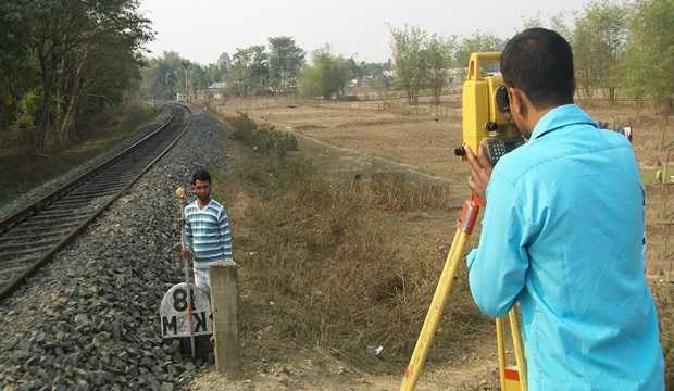
After map study and marking various possible alternative routes, the second stage of surveys for highway location is the reconnaissance survey. In this type of survey fairly wide stretch of land along the proposed routes is studjed. Very simple instruments like Tangent clinometers, Abney level, Barometer compass, etc. are used in this survey to collect details not available in the map
Objects of Reconnaissance Survey:
1. To locate positions of hills, valleys, lakes, ponds, marshy land, permanent structures, and other obstructions along the routes which are not available in the map.
2. To collect information regarding maximum flood level, underground water level, number, and type of cross drainage structures along the probable route.
3. To determine the value of gradient, length of gradient, and radius of curves of alternate alignment.
4. To obtain information regarding the type of soil along the routes.
5. To obtain information regarding climatic conditions in the area of the route.
6. To locate the sources of construction materials and water.
7. To collect data regarding the geological formation, type of rocks, seepage flow, etc., when the road passes through hilly terrain.
Give the standards for preparing the highway plans as per ministry of transport and highways.
Highway plans are the drawings prepared from the collected data during the highway survey. The following highway plans/ drawings are generally prepared in a highway project:
(a) Locality map-cum-site plan
(b) Land acquisitions plans
(c) Detailed plan and longitudinal section
(d) Detailed cross-section
(e) Drawings for cross-drainage
(f) Drawing of masonry works
(a) Locality map-cum-site plan
This is a combination of the keymap drawn to a scale of 1: 250,000 and the index map to a scale of 1: 50,000. This map should show the location of the project in the state and indicate the names of towns and cities.
(b) Land Acquisition Plans
This is prepared from the survey drawings for land acquisition details. Scales of 1: 2000 to 1: 8000 are suitable. These plans should show wells, land boundaries, trees, the nature of the land, and the nature of crops.
(c) Detailed Plan and Longitudinal Sections
The detailed plan should show the final center-ling, right-of-way boundaries, cross-roads, railway lines, one of the points of transit, location of cross-sections, contours, etc. The longitudinal section should show the final road profile, existing is to show both the plan and profile together in one sheet. These are drawn by using a scale of 1: 2600 for horizontal and 1:250 for vertical.
(d) Detailed Cros8-section
Cross-sections should be drawn at overy 50-100 m in plain terrain, 50-75 m in rolling terrain, and 20 m in hilly terrain. It is drawn to a scale 1:100. The cross-sections should show the existing ground profile, area of cut and fill, proposed road levels, etc.
(e) Drawing for cross-drainage
This is drawn to Boale of 1:50.
(f) Drawing of Masonry Work
This is usually drawn to a scale of 1: 100. For details of any complicated portion of structure scale of 1:10 may be used.
Survey for Road Project (Reconnaissance, Preliminary Survey, etc) | Highway Engineering
What do you mean by Highway Alignment? What are the various factors controlling alignment?
Highway alignment is the position of the centerline of the highway on the ground.
The alignment of a new road should be done very carefully and accurately.
Because once the road alignment and constructed it is very difficult to change the alignment due to the increase in the cost of adjoining land and the cost of shifting the costly structures along the roadsides.
Factors controlling alignment
The various factors which control the highway alignment are:
1. Obligatory points
2. Economy
3. Geometric
4. Traffic
5. Other Consideration
(1) Obligatory points: There are obligatory points through which road alignment has to pass and for this alignment has deviated from the shortest or easiest path. These points are intermediate town, bridge, a mountain pass, a quarry, etc. There are also obligatory points through which road alignment should ant pass and should be avoided while alignment a road. These points are like temples, church, mosques, marshy and waterlogged areas, etc.
(2) Economy: While finalizing the alignment this factor is also considered. In working out the economics, the initial cost of maintenance and vehicle operation should be taken into account.
The initial cost of construction can be decreased by choosing alignment in such a manner that cutting and filling are balanced.
(3) Geometric Design: Geometric design factors like sight distance, gradient, the radius of the curve, etc. also given the final alignment of the highway.
The alignment should be such that it provides enough visible distance for safe overtaking operation and for salo stopping of the vehicle. Alignment to be finalized should fulfill the sight distance requirements.
While alignment new road as far as possible the gradient should be flat and less than the ruling gradient. For this requirement the alignment is to be changed, Sometimes it may be necessary to make adjustments in the alignment of roads to obtain the minimum radius of the curve.
(4) Traffic: The alignment should suit the need of traffic. Before fixing any alignment, traffic studies should be carried out which give an idea about goods and passengers traffic expected on the proposed road.
If the traffic is mainly of slow-moving type, the alignment may be of winding nature joining all the villages.
Sharp curves any be allowed in such roads. But if the traffic is fast-moving, the proposed alignment should as far as possible be straight with easy curves.
(5) Other Considerations: Other factors which govern the alignment of reads are hydrological factors, political considerations, and monotony and drainage considerations.
The alignment should not cross the foreign territory. It may tend to change the alignment so as to keep the road away from land. To avoid monotony caused due to lengthy straight routes, a slight bend should be provided to break the monotony.
The vertical alignment if often guided by drainage considerations.
Discuss the process of preparing Reconnaissance Report.
After collecting the various information, a reconnaissance report is prepared in the following format:
(a)Introduction: This includes the following:
1. Purpose of reconnaissance survey
2. Study methods
3. Design criteria
(b) General Alignment details: In this, the following information is provided:
1. Choice of routes, including advantages and disadvantages of various routes.
2. Interchange locations.
3. Service to communities.
4. Safety considerations.
5. Drainage
(c) Project Cost Estimate: This includes the estimate of the following.
1. Roadway
2. Right-of-way
3. Utility re-location
4. Structures
(d) Summary: This includes conclusion and recommendations.
Finally, a plan drawn to scale 1: 50,000 showing the alternative alignment is attached.
Also, Read This.